When the sun, moon, and Earth align, keep your eye on Davis Bay.
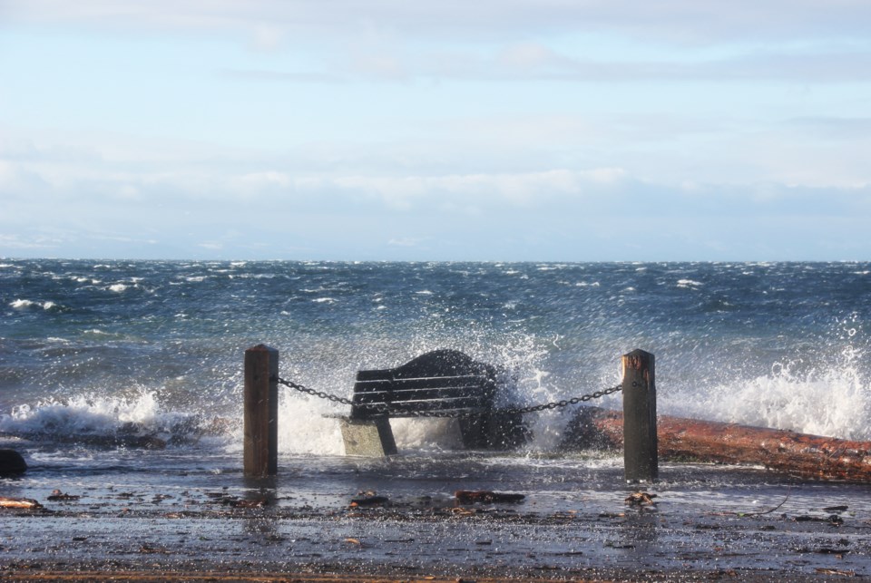
Crews were out last Friday, Jan. 7, mopping up after a king tide and high winds flooded part of Highway 101 through the low-lying neighbourhood. From climate change to the gravitational pull of celestial bodies – what was at play in the flooding in Davis Bay?
What is a king tide?
King tides are the biggest tides of the year, and occur when the sun, moon and Earth align in a single line, Alex Boston, the executive director of SFU’s Renewable Cities, told Coast Reporter.
There are other factors that affect the tide as well. Since the Earth moves elliptically around the sun – not in a perfect circle – the planet is closest to the sun in January. Although the lunar cycle impacts tides the most, the sun also has an effect on the ocean. When warm bodies of water push their way from another side of an ocean, warm water will expand and also affect the tide. Sea level rise, Boston says, can aggregate year over year to make a significant difference.
One Davis Bay resident also reported his weathervane showed winds upto 70 kilometres per hour, as the king tide hit the shores.
Although other parts of the Sunshine Coast can be sheltered by islands that interrupt strong winds, Davis Bay has an “open run all the way to Vancouver Island,” Boston said.
What can be done?
There are various short- and long-term solutions that could help mitigate tidal concerns and the “growing vulnerability along that stretch of highway,” Boston said. The municipality could consider a suite of solutions to phase in over time, he said, that could dissipate wave energy.
One potential solution could be putting artificial reefs in the offshore areas, but the local context would need to be explored to make sure an intended solution does not potentially exacerbate issues, Boston said. On the foreshore, using a porous, rocky interface could mitigate wave energy by absorbing the force of waves. Large ditches or green infrastructure (such as bioswales) could help move stormwater off the highway. Temporary dams, such as what West Vancouver implemented during the same tidal event on Jan. 7, could also help during king tides.
“One of the things that’s really important is to consider is not just the road and the beach, but it’s also the vulnerability of the properties, the business, the homes that are along that area,” Boston said.
More significant intervention may be required on a long-term basis. Boston pointed to a map by Climate Central that shows projected annual flood levels in 2050. The map shows the highway through parts of Davis Bay (and other sections of the Sunshine Coast) as beneath those predicted flood levels.
Whose job is it to respond?
Davis Bay and Trail Bay in Sechelt have a history of this type of event, Kirn Dhillon, the director of engineering and operations for the District of Sechelt said. The Ministry of Transportation and Infrastructure (MOTI) is the lead agency for the highway, and contracts Capilano Highway Services. The District of Sechelt will assist when the municipality’s crews can get to the scene of an event quicker, said Dhillon.
“The manager of parks and the manager of public works, they do monitor king tides and wind conditions to try and predict to some extent when and where these are going to happen,” Dhillon said.
MOTI undertook a corridor review of Highway 101 recently, and if the ministry addresses storm water drainage issues in the area, the District of Sechelt “would definitely join in their efforts and also try to work with them on that,” Dhillon added. Dhillon recommends drivers check www.DriveBC.ca for updates about road conditions and events.


