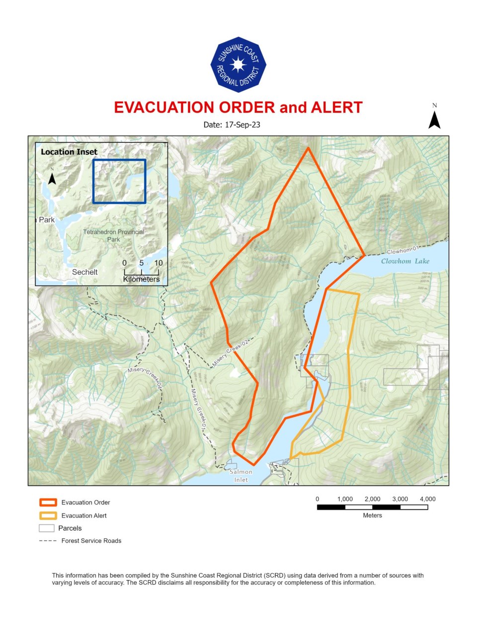
The Sunshine Coast Regional District (SCRD) emergency operations centre expanded the evacuation order zone for the Clowhom Lake fire Sunday to encompass 10 properties. The alert zone has also grown, but the expanded area is just Crown land, according to a news release from the SCRD.
When the evacuation order was issued Friday afternoon, it encompassed seven properties (but only one cabin structure was on said properties), with a further five properties on alert.
EOC director Rob Michael said the expanded order was made on recommendation from BC Wildfire Service (BCWS) based on the cold front the Coast is experiencing. "That's increasing our fire activity, we're still seeing that slow growth," said Michael.
The fire has grown to an estimated size of 450 hectares, said Michael Sunday afternoon – it was estimated at 231 hectares on Friday.
The BC Hydro dam and Independent Power Projet are still on evacuation alert, "but we're getting in touch with them to determine what the impacts would be if that area needed to be evacuated," said Michael.
Despite those pieces of infrastructure, the fire is still in a "fairly remote area," said Michael. "The general public aren't really at risk right now."
"This is precautionary at this point but we're able to pivot to more aggressive orders if required," he said.
The BCWS map says that structural protection crews are in place for properties and critical infrastructure within the order.
The public is asked to stay away from the area.
Track wildfire activity on the Sunshine Coast with the BCWS wildfire map.


