The sun is shining in Metro Vancouver but many B.C. highways are completely submerged following a powerful storm.
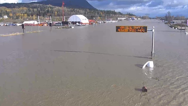
DriveBC's webcams show several major highways across the province underwater Tuesday (Nov. 16) afternoon following torrential rainfall over the weekend and through Monday.
The floodwaters have led to the evacuation of the City of Merrit. A state of local emergency has also been declared for the City of Abbotsford and many have been evacuated. Residents are encouraged to avoid travelling until the situation improves.
On Sunday, Abbotsford broke its all-time rainfall record after over 100 millimetres of rain fell in a single day. By 10 a.m. Monday, much of the region lay under a blanket of water, triggering an evacuation order for the Straiton area and the closure of over two dozen roads. Another five neighbourhoods remain on evacuation alert due to flooding and mudslides.
At one stretch of Highway 7 near Agassiz, up to 275 people — including about 50 children — were trapped in their vehicles overnight after two landslides pinned a line of cars between a hillside and the Fraser River. Rescue crews including the Canadian military are still working to evacuate residents still trapped in their vehicles or homes.
To find out current highway conditions, visit DriveBC online.
With files from Stefan Labbé and Alanna Kelly


