When last weekend’s “atmospheric river” slammed into B.C., devastating the province’s highway system and swamping the fertile Sumas Prairie, the scale of the destruction was initially hard to grasp.
Catastrophic road failures and flooding were separated by hundreds of kilometres of wilderness. In Abbotsford, the historic Sumas Lake was starting to reform after multiple dike failures.
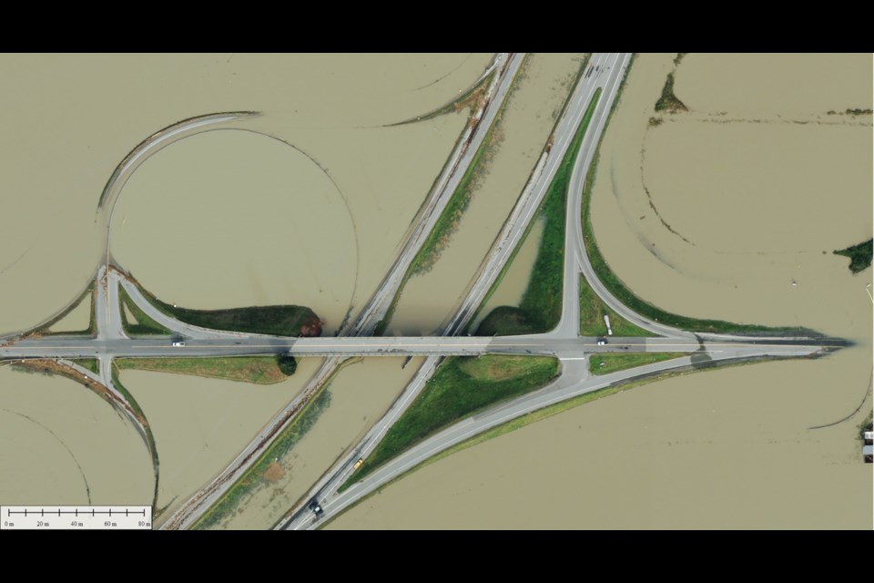
Abbotsford-based Peregrine Aerial Surveys was immediately hired to provide aerial mapping of a fluid situation. Some of the company’s strikingly detailed images have since been posted to social media and shared widely.
“I was sitting at my house, watching. I had to dig a ditch on my house to try to alleviate the flooding on my patio,” said company president Paul Gagnon, adding they were eager to help their community understand the scale of the calamity.
It takes an aircraft between 45 and 60 minutes to fully map the entire Sumas Prairie, he said. The surveys have allowed officials to monitor the movement of incredible amounts of water over a large area.
The company has also been hired to survey damage of highway corridors in the Similkameen, Fraser Canyon and Coquihalla.
Aircraft are fixed with a Leica DMC3, valued at about $2 million, that take photographs at 375 megapixels, allowing for striking clarity from 8,000 feet.
Gagnon said the company’s recent trips over the Sumas Prairie have been marked by an incredible amount of air traffic.
“It's probably the busiest that we've seen it in the air for certainly in recent memory,” he said, explaining emergency and search and rescue aircraft have filled the sky.
Peregrine has also posted a comparison of their flights over the Sumas Prairie, showing the movement of water and improving conditions. Gagnon said they will be back up in the air next week to resurvey the area as the water recedes.


