VANCOUVER — Favourable wind conditions may help control the wildfires that have been raging near Fort St. John in northeastern British Columbia for the last two weeks, and fire crews say possible rain over the weekend could further temper the flames.
A fire information officer says three of the four large wildfires that have been burning 1,200 kilometres northeast of Vancouver have not grown at all since Friday.
"Things are looking quite good," Karley Desrosiers said on Saturday about the blazes in the Red Creek, Cameron River and Boundary Lake areas
"We are expecting some rain in the forecast so, hopefully by Monday, we will get some precipitation...That will certainly reduce fire behaviour."
Stoddart Creek --- the largest of the blazes --- is the only one that expanded just before the weekend, although only by a modest six square kilometres to 266 as southerly winds pushed flames north.
Environment Canada is forecasting a 30-to-40 per cent chance of showers for Fort St. John on Saturday and Sunday, followed by rain on Monday.
But the forecast is also calling for thunderstorms over the weekend, and Desrosiers said crews are on the watch for "dry lightning" and any new potential fires that may get ignited if rain does not fall in significant amounts.
Earlier, the B.C. provincial government warned residents that a return to cooler, more seasonal spring conditions may actually raise the risk of lightning-caused wildfires after the province experienced a prolonged period of dryness and heat.
Desrosiers said the BC Wildfire Service is ready to manage those fires if they do get sparked.
"We do have the capacity to respond to new incidents if they were to occur in this area," she said. "But at this point, we do believe that rain will accompany that (storm)."
The other challenge that comes with cooling weather, Desrosiers said, is the changing wind direction.
Environment Canada says northerly winds may return later this weekend, which would push the fire south again towards Highway 97 and other populated areas like Fort St. John.
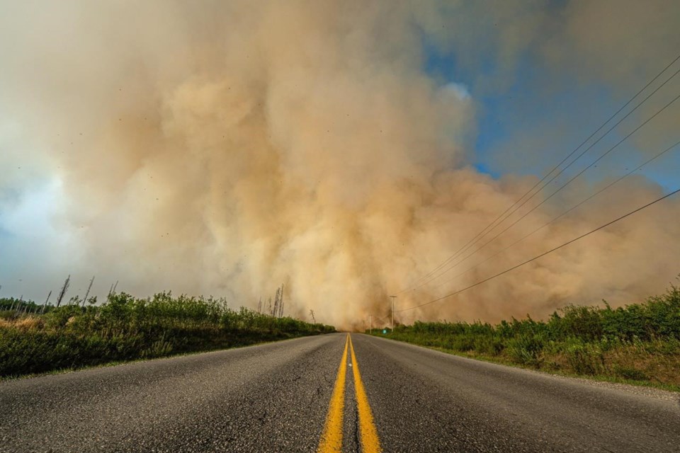
That is what happened on May 15, when southbound gusts exceeding 60 kilometres per hour pushed the Stoddart Creek fire and its smoke towards the city of 21,000, prompting an alert to prepare for evacuation that has since been rescinded.
Desrosiers said winds are currently southerly, pushing the flames north. This allows fire crews to conduct a controlled burn near Highway 97 that would significantly boost the lines of defence when the wind direction is forecasted to change back towards the south later in the weekend.
"There's a big pocket of unburnt fuel there that we would like to to remove in a controlled manner... while the winds are cooperative," Desrosiers said.
She said wildfire service crews are working around the clock on fighting all four fires in the region.
This report by The Canadian Press was first published May 20, 2023.
Chuck Chiang, The Canadian Press


