Municipalities are increasingly turning to AI solutions to help maintain roads, a move that city staff in Nanaimo and Victoria say has potential to be cheaper and more efficient than previous technologies.
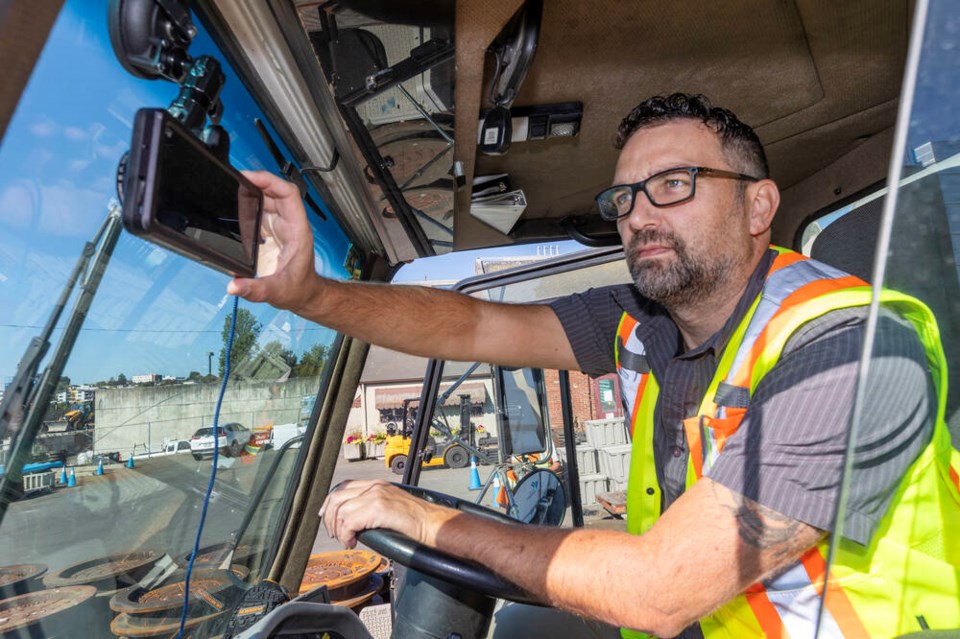
David Thompson, acting manager of Nanaimo’s public works department, said AI tools help his department keep on top of changes to roads around the city.
“We’ve got over 500 kilometres of roadways and at this time of the year, they’re constantly getting ripped up and repaired.”
Nanaimo is in the middle of a three-year trial of RoadAI, a visual computing AI tool from Finnish company Vaisala.
The tool maps out road conditions — potholes, previous repairs, road markings, street signs — and assesses them according to industry standards by analyzing video taken by cameras mounted on city vehicles.
“Within four to six hours, we’ve got an analysis of that video and what the road conditions are like, and it’s all mapped against our GIS [Geographic Information System],” Thompson said. “We’ve got access to videos of the entire city at our desktop.”
“We can basically re-inspect any piece of road, anytime we want.”
The service costs about $40,000 annually, which Thompson said is a bargain compared with the service that the city had relied on for the past quarter-century to update its road records.
Previously, the city hired a contractor with a van outfitted with lasers and other specialized equipment every three to five years to make a close inspection of all of the roads Nanaimo is responsible for maintaining.
The process usually takes about three or four weeks and costs between $180,000 to $200,000 each time, Thompson said. “Now, we can do an inspection anytime we want. We don’t have to wait for the contractor, we don’t have to incur those costs.”
Thompson said the AI tool struggles with video taken in rain and snow.
But as the technology improves, it’s possible to reprocess old video and get more data out of it, he said.
Nanaimo is hoping to use the data generated to find ways to make public works more efficient. “There’s way more work to be done than we can accomplish with the budgets and staffing … so it really comes down to what is the best bang for the buck. And we can use these tools to help us make better decisions.”
Meanwhile, Victoria has been running a more basic AI-powered pothole detector on its streets since 2023.
Simon Upshon, Victoria’s acting assistant director of public works, said that ever since the tool was deployed, the city has been getting fewer calls about potholes.
“Having the AI tool allows us to be a lot more proactive,” he said. “We started it as a six-month [trial], but we saw value in it very quickly so we’ve extended it all the way through and we still use it today.”
The tool, Rover AI, is provided by CITYROVER, a New York-based company and costs less than $4,500 annually.
The city’s automated pothole detector relies on a single dash camera mounted on a city sweeper, which usually makes a full visit of all 270 kilometres of the city’s public roads every six weeks as it works to keep the streets clean.
The video from the sweeper is uploaded to servers and processed with an AI tool that identifies inconsistencies in the pavement.
Upshon said the city opted for the most basic service, skipping out on service packages that help with snow response and in identifying other issues such as fading line markers and bent sign poles.
Before it took on the pothole-detecting AI program, the city relied on a mix of reports from the public and public works staff noticing issues while out on the road to other jobs.
“It’s definitely more efficient than sending a staff member out to go find potholes, and it’s definitely a lot more efficient than when we used to send our teams out to go find where the reports were for potholes,” Upshon said, adding that the tool gives crews images of the potholes with exact GPS coordinates.
However, the tool isn’t perfect.
The city first mounted Rover AI on a garbage pick-up truck, but the constant backing up of those vehicles caused duplicate readings, he said.
False readings, like those caused by shadows, can appear from time to time.
The city still verifies AI-generated pothole data with an in-person visit, Upshon said.
If there really is a pothole, crews fix the issue with recycled asphalt from the city’s asphalt plant, with priority fixes going to the most severe cases.
Smaller cracks are sealed with a rubberized sealant to prevent them from getting worse.
Upson said that the most common call into the public works department has shifted from pothole complaints to complaints about road construction — sometimes caused by the work crews fixing potholes.
“There’s always something that’s being called in,” he said good-naturedly.


