Sunshine Coast residents relying on the Chapman Water System should prepare for another business-as-usual summer on the water supply front thanks to the delayed issuance of a highly-anticipated water licence required to move ahead with the Church Road Well project.
“Over the last several days it has become very apparent that the timeline for this project will need to be altered,” said Sunshine Coast Regional District (SCRD) infrastructure services manager Remko Rosenboom during a Nov. 6 committee meeting.
Staff were hopeful the well field, located near the corner of Elphinstone Avenue and Church Road in Granthams Landing, would be commissioned by mid-summer 2021. The project could reduce the Chapman Water System’s supply deficit by 50 per cent.
Rosenboom said the province hasn’t committed to a new timeline yet, but staff are “confident” it will be commissioned prior to summer 2022.
The SCRD had been seeking a one-year turnaround on the provincial adjudication process for the water licence – a process that normally takes two years for similar projects.
They submitted their application in October 2019 and the minister had committed to prioritizing it, resulting in an “active and productive” collaboration between the province and the SCRD, said Rosenboom, but ultimately the timeline had “proven not to be realistic.” He said the water licence is expected “in the coming months.”
That delay means the water supply situation for the Chapman Water System in 2021 “will be comparable to what we had for the last several years,” he said.
About $536,000 of the $8.3 million budgeted for the project has been spent.
Rosenboom said the delay means staff can explore grant opportunities rather than relying on a long-term loan, which was approved through an Alternative Approval Process earlier this year.
When asked for more specifics about the delay, Rosenboom gave three reasons.
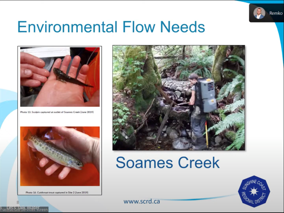
First, large portions of a 2019 data set were damaged when monitoring equipment was swept away by Soames Creek, so staff were forced to play catch up this spring.
The province and SCRD are still working on establishing the creek’s Environmental Flow Needs, said Rosenboom, who described the creek as “quite a complex situation in terms of hydrogeology.”
The province is also still trying to understand how the aquifer functions. “We need to have more communication with the province so they are comfortable with their understanding,” he said.
Third, the province wants more support from the SCRD in its consultation with Sḵwx̱wú7mesh Nation.
A project notification report published last August as part of a successful review by B.C.’s Environmental Assessment Office said the Nation had requested “capacity funding” from the SCRD so it could review the project, but the SCRD declined because it could not provide the funds. The Nation did not raise any objections to the project.
Sechelt director Alton Toth asked whether construction could move ahead without approvals, but Rosenboom said doing so would introduce risk in case the province rejects the application.
Elphinstone director Donna McMahon asked about the severe drainage issue leading to erosion of sections of Elphinstone Avenue, close to where the well field is located, and the expansion of a steep ravine with a waterfall pummelling the Soames Creek bed.
“If this project is deferred this means we’re going to go through another winter with this severe problem just worsening. Is there any prospect that we can work with MOTI to manage this?” asked McMahon.
The width of Elphinstone Avenue will be repaved after the watermain is installed, along with impacted areas of Fisher Avenue and Reed Road, but Rosenboom said MOTI still needs to conduct an assessment to determine how to address the drainage issue causing the Soames Creek washout.
Initially, a watermain was supposed to be installed on the north side of Reed Road, which is a suspected source of the drainage issue, but the latest plan changed its location to the south side, between Fisher Road and Payne Road.


