Environment Canada says an “unseasonably strong” Pacific frontal system is bearing down on B.C.’s south coast, bringing heavy rain to the Sunshine Coast area Thursday afternoon.
In a special weather statement issued Aug. 1, forecasters said, “The system will tap into subtropical moisture, which will amplify the front and help to enhance the rainfall.”
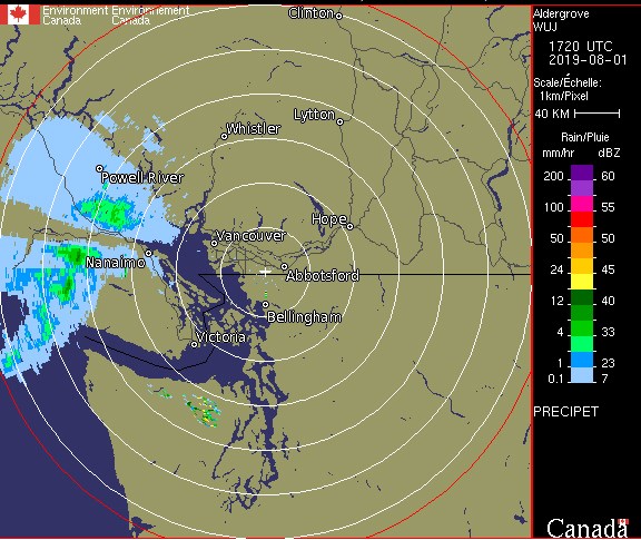
The rain was expected to start over west and inland Vancouver Island Thursday morning and spread across the central Island, and the upper Sunshine Coast, where 50 mm of rain was forecast for Powell River before moving south.
Heavy rain on the lower Sunshine Coast is predicted to start in the afternoon as the front intensifies.
“The continuous rain will end overnight or early Friday morning as the front pushes to the east. In the wake of the front, there will be showers with a risk of thunderstorms and gusty winds through Friday,” the weather statement said. “There remains some uncertainty with respect to the location of where the heaviest precipitation amounts will occur.”
Forecasters are predicting a return to typical August long weekend weather by Saturday, which is expected to be sunny with a high in the low 20s.
Environment Canada is encouraging people to check the latest forecasts, and monitor alerts.


