“How’s the road at Trout Lake?” is a common query among local Highway 101 travellers, especially when storms hit. In the coming months, the public will be able to gauge the area’s conditions from anywhere via the DriveBC website.
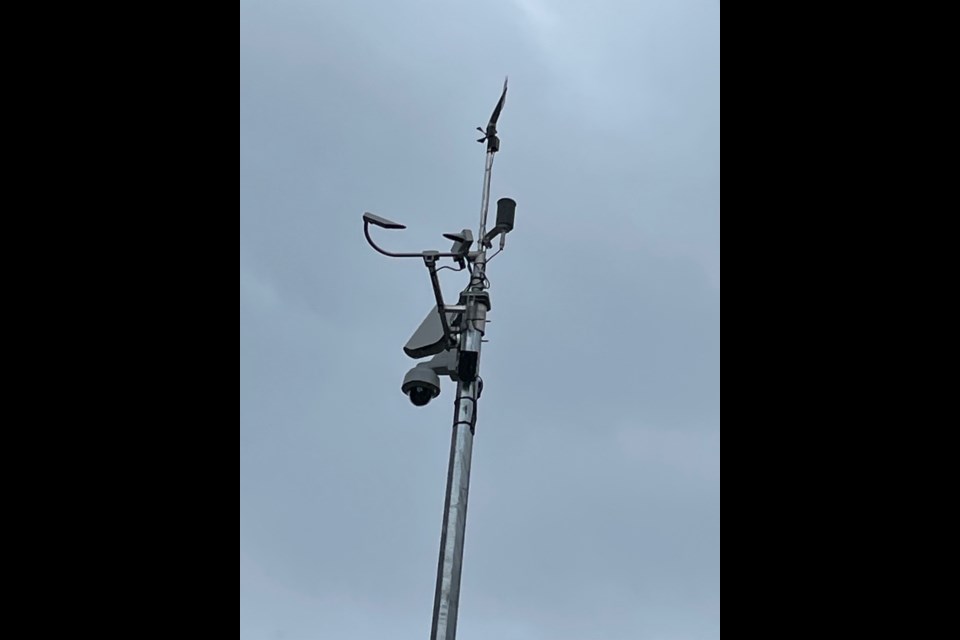
Tyler Lambert, spokesperson with the local Capilano Highway Services office, said a Ministry of Transportation and Infrastructure (MOTI) road and weather information station at the site is being commissioned. A webcam to supply real-time visuals, lighting and a small weather station now sit atop a pole installed in early September across from the lake, alongside the south-bound traffic lane. The goal, he has been told by MOTI, is to have those operational “before the winter hits."
In a Sept. 26 email, a MOTI spokesperson indicated the weather station, which cost about $150,000 to install, will go live as soon as BC Hydro completes power service to the tower. There are no additional such weather stations planned for the Sunshine Coast, according to that communication.
Details on road surface and air temperatures, wind speed and direction and precipitation from the new equipment will be available to Capilano, MOTI’s local road maintenance contractor. Speaking with Coast Reporter on Sept 22, Lambert said while he was not aware of plans to make the weather data public, Capilano is “very happy” that access to more information on Highway 101 driving conditions is coming.
“It will improve our winter maintenance for sure, as we will be able to see what the road is doing; is it freezing, is it not freezing,” he said. Along with the ability for his organization to remotely monitor and “get out ahead” of weather situations that impact highway safety, he said having the public able to check on road conditions and factor those into decisions about driving the route will benefit all travellers.
“Trout Lake has the most severe winter conditions of anywhere as it is the highest spot on the highway, from one end to the other,” Lambert stated. That, he said, was the reason Capilano put in a request to have the site installed.
Already available on DriveBC’s website are lower Sunshine Coast Highway 101 camera feeds from Stewart (Gibsons bypass), Brooks (6 km north of Trout Lake), and Egmont (1 km south of Earls Cove ferry terminal) Roads. In the qathet regional district, conditions are shown from Loubert Road (10 km north of Saltery Bay ferry terminal) and a site 8.5 km south of Lund.


